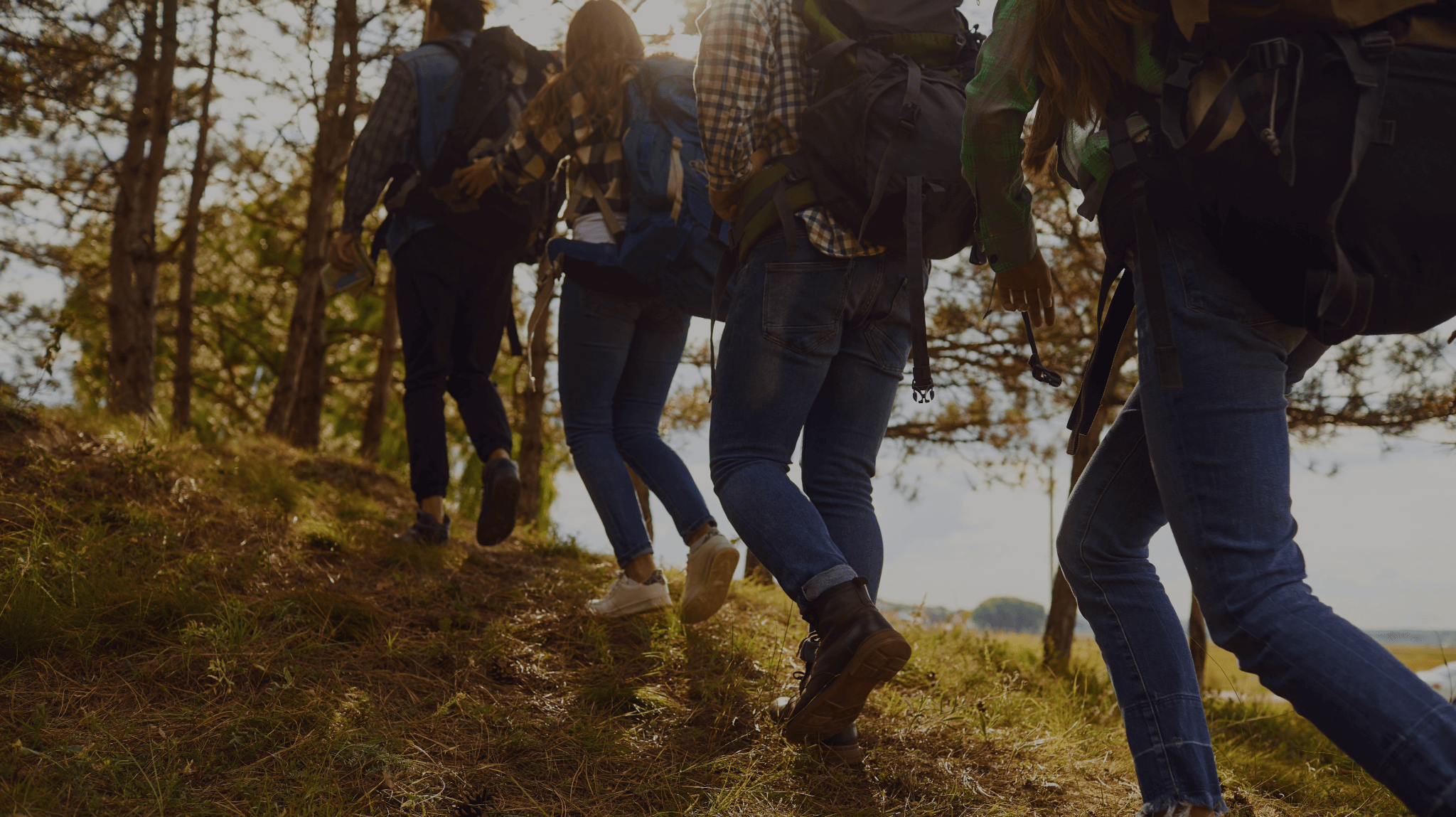
In honor of National Trails Day on June 7, we’re celebrating one of our favorite tourism website products: our Trails features!
To date, we’ve developed two versions of this product: a creative version that promotes themed trails in a community and another that promotes more traditional recreational trails. Both versions provide website visitors with a new way to explore things to do in a region and plan out their trip to the area!
Unique Trails
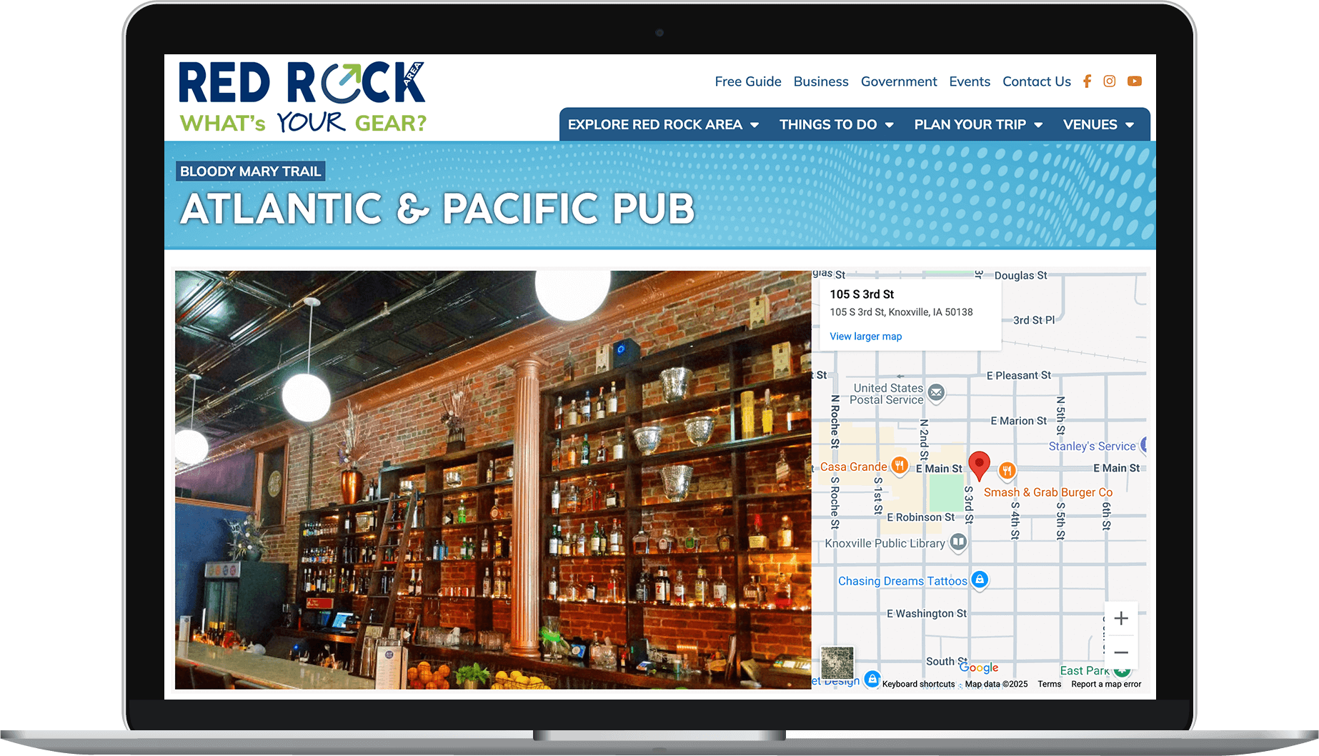
Our original Trails feature was developed with more out-of-the-box stops in mind — think a trail to all of the best burger places in town or a trail that winds through all of the antique stores in the area. Our latest tourism client to use the feature is Red Rock Area, who is currently using it to promote a Bloody Mary Trail and a Boutique Trail.
The Trails feature enables Red Rock Area to create a custom trail and then associate existing attraction, dining, lodging, and venue listings with it. These listings are then added to the trails page and receive a label on their existing listing page, noting that they’re part of the trail to cross-promote the trails on other areas of the website.
The feature is built to grow with Red Rock Area so they can continue to add new trails and can highlight different trails seasonally as desired.
Recreational Trails
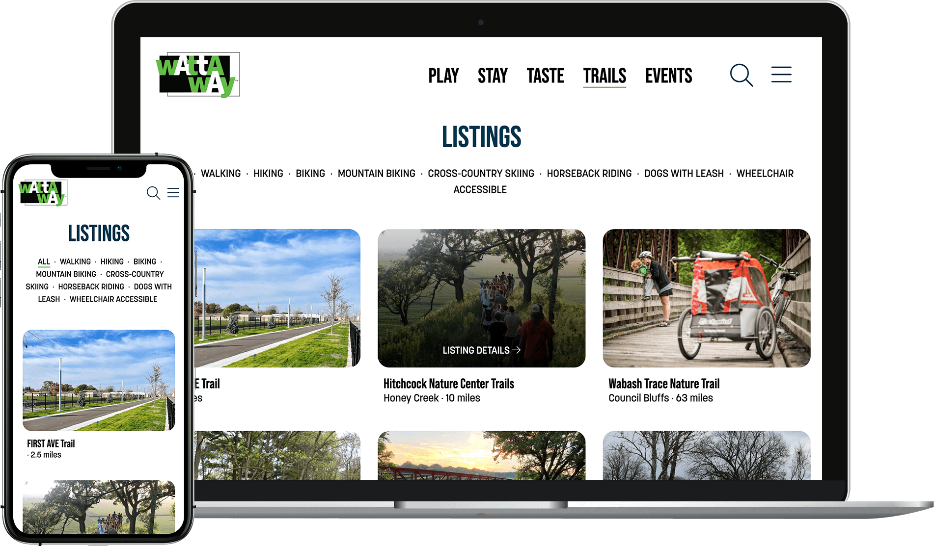
A couple of years ago, we built a new Recreational Trails feature for the Council Bluffs Convention & Visitors Bureau and their tourism partner, Pottawattamie Tourism Committee. The Recreational Trails feature allows them to promote more traditional trails, such as those for hiking and biking, and even cross-country skiing and horseback riding.
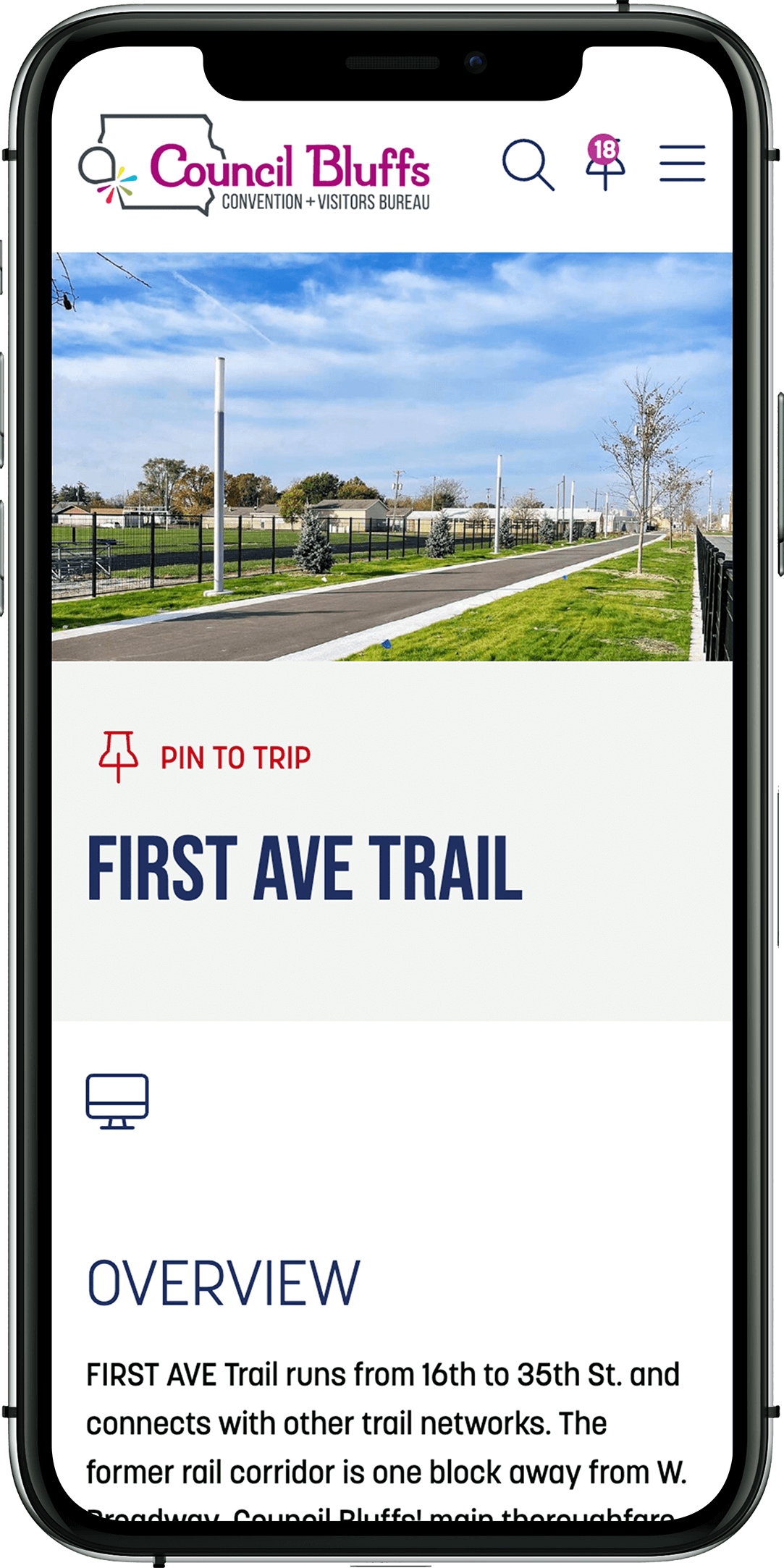
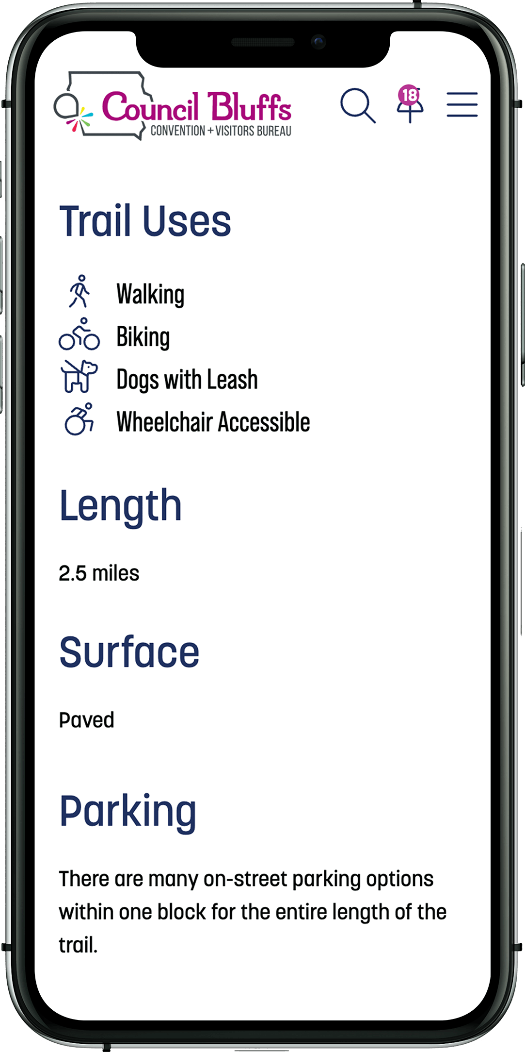
The feature allows clients to add key details about each trail, including whether it’s paved, how easy it is, activities allowed on the trail (such as if it’s dog-friendly), the length, any fees, and parking instructions. An update to the feature also now provides a way to list nearby restaurants, helping visitors and residents plan out their trek (it certainly never hurts to make sure there’s good food nearby after some exercise!).
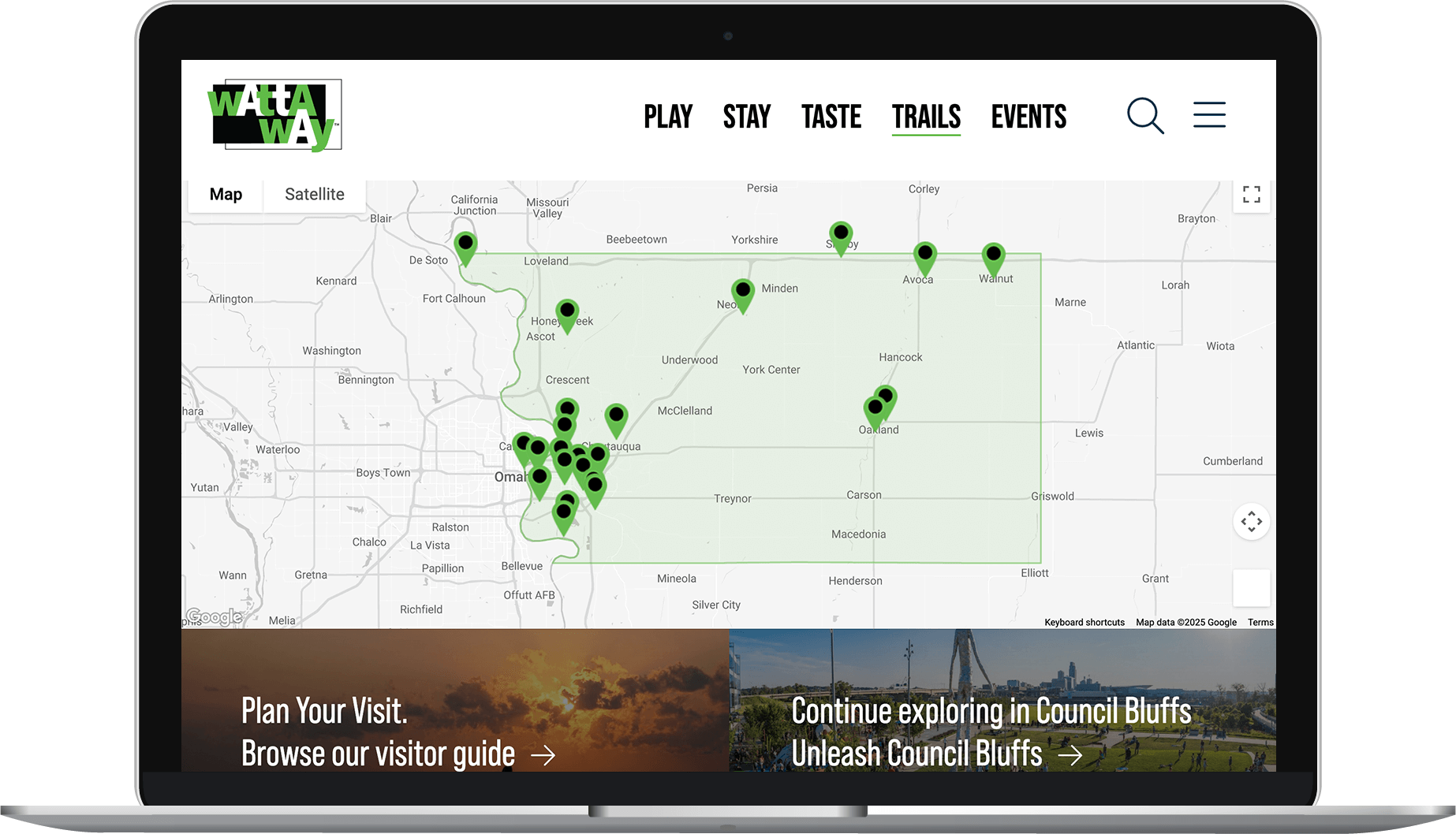
Trail markers can also be included to map out start and end points. The Pottawattamie Tourism Committee version of the feature includes the trails on an interactive map of the county, making it easy to visualize the location of each trail.
Let's Take a Stroll
Do you have trails you’d like to promote? We’d love to chat about how we can assist!